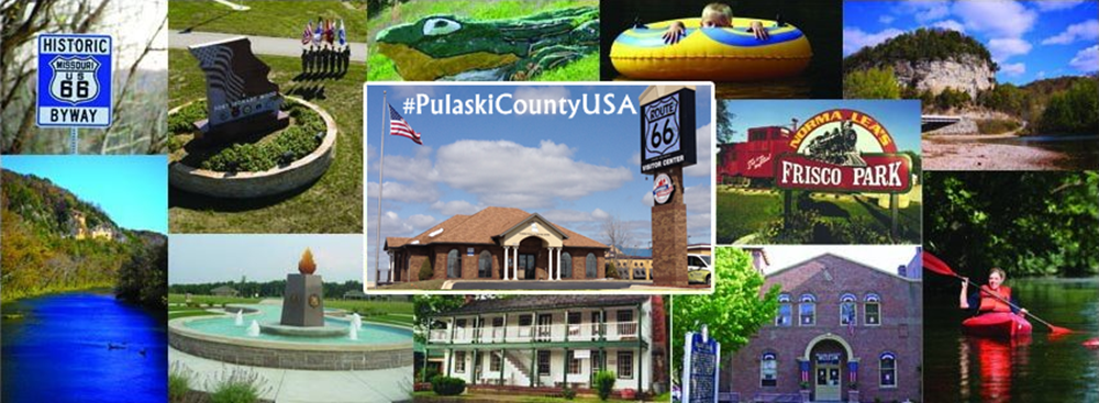
Ingress agents love road trips! And Pulaski County is road trip country! Gather up your fellow agents and experience a day, or weekend, exploring legendary trails and roads, multiple eras of rich military history, and railroad boom towns.

It’s happening all around you. They
aren’t coming. They’re already here.
Pulaski County is home to Fort Leonard Wood, Saint Robert, Waynesville, Crocker, Dixon, Richland, over 100 portals (gazillions awaiting approval), several missions, and #PortalGem worthy “Frog Rock”.
Pulaski County’s “can’t miss” portals include:
Devils Elbow Post Office– On the original alignment of Route 66 and also on the banks of the Big Piney River, this charming village’s current Post Office was built in 1954. Bring your camera and your appetite to this portal. The nearby 1923 Devils Elbow Bridge & the dramatic bluffs are very photogenic.
BEHIND THE SCANNER- You will also want to visit the Elbow Inn & BBQ, just across the bridge. This roadhouse has been serving delicious barbecue to hungry travelers since the 1930’s. Ask the barkeep about the day the Sports Illustrated Swimsuit Edition models held a photo shoot here- and what they left behind!
GPS Coordinates: 37.846461, -92.061351

Devils Elbow Post Office is housed in Sheldens Market.
WWII Memorial– Also on Route 66, this Desert Storm era M-60 tank pays tribute to U.S. Veterans. Beginning in 1941, nearby Fort Leonard Wood has been the starting location of millions of U.S. Army careers and this tank honors them, and all members of the Armed Forces. This portal is a waypoint on the “Purple Heart City” mission.
BEHIND THE SCANNER- The tank is located in George M. Reed Roadside Park– the last roadside park remaining in Missouri on Route 66. Make your Route 66 experience authentic with a roadside picnic lunch in the park! Don’t have fixin’s for lunch with you? Many of Saint Robert’s dining establishments offer carryout.
GPS Coordinates: 37.821337, -92.147403

M-60 Tank at George M. Reed Roadside Park in Saint Robert, MO.
Frog Rock– Greeting motorists into Waynesville since 1996, Frog Rock (a/k/a W.H. Croaker) has quickly became a world famous Route 66 icon. The frog sculpture was chipped away, by tattoo artist Phil Nelson, from a leftover boulder after Missouri Department of Transportation (MODOT) widened Waynesville Hill. This portal is a waypoint on the “Finer Than A Frog’s Hair” mission.
BEHIND THE SCANNER- Frog Rock is celebrated every October in Waynesville during the popular “Frogtoberfest” festival. Frog Rock has also inspired a pub on the Square- Hoppers. Hoppers is well known for its selection of 66 beers on tap, casual fun atmosphere, and its tasty menu items- like the Jam Burger!
GPS Coordinates: 37.827002, -92.192381

Frog Rock in Waynesville is a #PortalGem. Photo by Cat Spencer.
Waynesville Fort– In the early days of the Civil War, Waynesville, the seat of Pulaski County, was overwhelmingly pro-secessionist, and its citizens flew the Stars and Bars to show their Confederate support. The flag was lowered shortly before Federal troops marched down Waynesville Hill, set up camp, and erected a small fort near a bluff overlooking the Roubidoux Spring. Colonel Sigel had been tasked to “Occupy Waynesville. Keep open the road from Rolla to the Gasconade and clear the surrounding country of Guerillas”. This post served as a Federal supply base on the route between Rolla and Lebanon, and as was common for all of the military posts in Missouri, probably held local civilian prisoners deemed disloyal. The 5th (formerly 13th) Cavalry, State Militia, used Fort Waynesville as its base of operations in the military District of Rolla, serving there from the spring of 1863 until the war ended. Today, visible traces of the fort have disappeared to the naked eye, but members of Pulaski County Historical Society erected a historical marker in 1970 to preserve the memory of Fort Waynesville. This portal is a waypoint on the “Take The Square” mission.
BEHIND THE SCANNER- Travel south on Dewitt Street and then west on Benton Street as it’s curve follows the bluff for sweeping panoramic views and a bird’s eye view of Roubidoux Spring in Laughlin Park. A short side trip to Laughlin Park will lead you to one of only seven designated sites on the National Trail of Tears Trail in Missouri. The site features interpretive signage about this tragic historical event.
GPS Coordinates: 37.82693, -92.200634

Fort Waynesville Historical Marker
Old Stagecoach Stop– One of Pulaski County’s oldest buildings, the Old Stagecoach Stop on the Square in Waynesville was “built of logs in pioneer days, used as a stage coach stop and a tavern of rest for weary travelers westward bound. In 1862 the building was commandeered by the Union Forces and used as a hospital for the duration of the Civil War. After the war ended, it was remodeled and again served as a hotel for another half Century.”. The building was added to the National Register of Historic Places during the early 1980’s. This portal is a waypoint on the “Finer Than A Frog’s Hair” mission.
BEHIND THE SCANNER- At the time of the NRHP nomination the Old Stagecoach Stop was in the advanced stages of neglect. In 1983 citizens incorporated the Old Stagecoach Stop Foundation for the express purpose of saving the building from demolition. Thanks to their success the building also now serves as a museum. You can visit the Old Stagecoach Stop Museum every Saturday April through September from 10 am until 4 pm. Admission is free, donations are accepted. Make sure to visit the nearby Route 66 Courthouse Museum also!
GPS Coordinates: 37.829205, -92.200511

Old Stagecoach Stop in Waynesville, MO. Photo by Terry Primas.
Freedom Church– Located in Dixon, one of Pulaski County’s Frisco Railroad boom towns. At one point in time this rural community was home to 22 churches of various denominations. This portal is a waypoint on the “Dixon, MO Steeplechase” mission.
BEHIND THE SCANNER- Di Trapani’s Italian Bistro is a destination restaurant near Dixon that features mouth watering dishes and breathtaking views of Portuguese Point on the Gasconade River. Each September Dixon is home to ShrimpFestival and Cow Days- a multi day street festival that dates back to the Great Depression. Nearby Boiling Spring Campground is home to Mid-Missouri’s largest precision cut corn maze each Fall. Baseball fans should make the pilgrimage to Wally Schang’s final resting place in Dixon Cemetery.
GPS Coordinates: 37.991892, -92.095468

Play Ingress in Pulaski County!
Frisco Caboose Monument– Crocker is also one of Pulaski County’s Frisco Railroad boom towns and the town has a deep appreciation of its railroading heritage. Prominently featured in Norma Lea’s Frisco Park, this bright red caboose is an eye catcher. This cupola caboose was built out of a boxcar in 1975 in Springfield, MO and was originally numbered #1418. It acquired it’s #11648 number via the Burlington Northern railroad company before it was retired. This portal is a waypoint on the “Crocker Fireball Run” mission.
BEHIND THE SCANNER- Crocker’s Frisco Caboose, and the nearby Frisco Depot Museum, are featured in Season 8 of Fireball Run. The museum is open by appointment and during the annual Railroad Days festival.
GPS Coordinates: 37.949155, -92.263543

Frisco Railroad Caboose in Crocker, MO
Burlington Northern Caboose– Richland is Pulaski County’s western most railroad town and Burlington Northern Caboose #11339 has made its home in Shady Dell Park. This cupola caboose was built in 1951 as #1007 for Northern Pacific Railway. After Northern Pacific was merged into Burlington Northern in 1970 this caboose operated in Earlville, Illinois. An archived photograph by Chuck Zeiler documents this caboose in Clyde, Illinois during 1981. This portal is a waypoint on the “Richland- Frisco Boom Town” mission.
BEHIND THE SCANNER- The intersection of Pine and McClurg streets is a pristine example of a typical layout of a railroad town. Commercial buildings are located on each side of the tracks. On the southeast corner is H.E. Warren Store. This store was founded by Captain Henry Ernest Warren in 1869 and is still owned and operated by his descendants 146 years later. This store is believed to be one of the longest continually operating family stores in Missouri.
GPS Coordinates: 37.855957, -92.396692

Shady Dell Park in Richland is home to a Burlington Northern Caboose.
Have you not chose your side yet? Learn more about Ingress game play: http://www.ingress.com
Order your free Pulaski County USA Visitors Guide & Driving Tours brochure at www.PulaskiCountyUSA.com

Order your free Pulaski County travel guides today! 877-858-8687

Rob
Did you save the post a few weeks ago that had several areas to visit like cliffy creek natural bridge?
Rick
Reblogged this on Ingress Resistance Front line Reports and commented:
Hitchhikers Guide To Ingress In Pulaski County
Pingback: This Week Around Pulaski County USA! | Pulaski County USA
Pingback: Ingress Mission Spotlight: Hidden History- Waynesville, MO | Pulaski County USA
Pingback: Ingress Mission Spotlight: Purple Heart City (Saint Robert, MO) | Pulaski County USA
Pingback: Ingress Mission Spotlight: Crocker Fireball Run (Crocker, MO) | Pulaski County USA