Pokémon GO is all the rage in Pulaski County, Missouri and across the United States. It is fantastic way to get you, and your family, outside to explore the world around you. This isn’t a new concept to many people across the country who have been exploring the cityscapes and countrysides as Ingress agents. Ingress, released in December 2014, is the first augmented reality game by Niantic Labs.
Pokémon Go is making a splash across Pulaski County, Missouri!
Niantic Labs was founded in 2010 by John Hanke, as an internal startup of Google, and became its own entity in 2015. Ingress agents around the world submitted locations to become in-game portals. These Ingress game portals are now also being used as Pokéstops and Gymnasiums by Pokémon trainers. Many of these locations are historically significant or feature public works of art. Some examples in Pulaski County include several locations on the Square in Waynesville and veterans memorials in Saint Robert. Public green spaces can also be Ingress portals/Pokéstops. These include locations in parks in Crocker, Dixon, & Richland.
Ingress- It’s happening all around you. They aren’t coming. They’re already here.
Game play is markedly different between the two platforms. If Pokémon isn’t your style, but a battle for world domination appeals to you check out the Ingress app on your smart phone. If you are on a mission to “catch them all” and are looking for Pokémon in Pulaski County, check out our past Ingress articles. Many of them give Ingress Portal locations- which will make Pokémon trainers happy campers!
Enjoy the world around you, as an Ingress agent or as a Pokémon trainer, but always be aware of your surroundings. Pokémon can trespass and break traffic rules, but human Pokémon trainers and Ingress agents can not.
*TIP- Pulaski County Tourism Bureau & Visitors Center, located at 137 St. Robert Boulevard, Saint Robert, Missouri is a Pokémon gymnasium. Be sure to stop in for free area travel information and maps.
Pulaski County Tourism Bureau & Visitors Center is a Pokémon Gymnasium and an Ingress Portal
It’s happening all around you. They aren’t coming. They’re already here.
Inspired by real, or imagined, events that took place during the Prohibition era in Pulaski County this hack mission roughly follows the same route (Highway 28 and Highway 133) that would have supplied Franks, Dixon, Helm, Hancock, Crocker, Swedeborg, Richland, and points in between, with moonshine. Be stealthy- the Sheriff’s ghost could be on patrol looking for illegal hooch!
Devils Elbow Post Office
Image by bchrismer via Panoramio.com
Dixon Lion’s Club Park
Dixon Towersite
Crocker Water Tower
Frisco Caboose Monument
During Season 8, filmed in 2014, the teams raced across America’s Frontier, including Pulaski County. This mission takes you on a portal tour of the town including the Frisco Caboose that was a mission stop for Fireball Run Teams.
Get your Fireball Run Ingress Mission badge by completing Crocker Fireball Run in Crocker, MO!
Crocker Presbyterian Church- Crocker Presbyterian Church was organized August 13th, 1893, and has holding services for 122 years.
Pulaski County Helipad- Spearheaded by Benny Doolin, who saw a need for emergency landing zones across the county, this pad was dedicated in 1998 and named in honor of Norma Mihalveich.
It’s happening all around you. They aren’t coming. They’re already here.
Indian Memorial- This totem pole in Crocker Community Park was a gift from members of a woodcarving club.
Crocker City Park- Crocker City Park features a walking trail that encircles a small lake. It is also home to rodeos and other community events throughout the year.
There’s more than one portal in Crocker Community Park! Photo by Laura Huffman.
Crocker Water Tower-
Crocker Post Office- Named for a stockholder in the Atlantic & Pacific Railroad, this post office has been serving citizens since 1869.
Frisco Caboose Monument- Crocker is also one of Pulaski County’s Frisco Railroad boom towns and the town has a deep appreciation of its railroading heritage. Prominently featured in Norma Lea’s Frisco Park, this bright red caboose is an eye catcher. This cupola caboose was built out of a boxcar in 1975 in Springfield, MO and was originally numbered #1418. It acquired it’s #11648 number via the Burlington Northern railroad company before it was retired.
Purple Heart City (Saint Robert, MO) Ingress Mission screenshot
Saint Robert is the youngest city in Pulaski County. The city sprouted up along the “spur” to Fort Leonard Wood in the early 1940’s and has always been proud to be home to our military heroes. In 2013, Saint Robert was the first city on the Interstate 44 corridor in Missouri to be named a Purple Heart City. This mission highlights several of Saint Robert’s salutes to the United States Armed Forces. You can complete the waypoints in any order.
Military Heroes War Memorial- Near the intersection of Missouri Avenue and Old Route 66, this memorial was dedicated May, 2013. The City of Saint Robert seal is flanked by the seals of the United States Army, United States Marine Corps, United States Navy, United States Air Force, United States Coast Guard and the US Army Maneuver Support Center of Excellence insignia.
Heroes Plaque- Located in the historic George M. Reed Roadside Park on Old Route 66. This memorial is dedicated by the citizens of the city of St. Robert to the brave service men and women and their families who have sacrificed to protect our nation.
Desert Storm Tank- Located near the Heroes Plaque this Desert Storm era M60 tank pays tribute to our Desert Storm combat veterans and is also a great photo opportunity.
M-60 Tank at George M. Reed Roadside Park in Saint Robert, MO.
Patriotic Water Tower- Located on St. Robert Boulevard, east of Pulaski County Tourism Bureau and Visitors Center. This patriotic themed water tower was a finalist in Tnemec’s 2012 Tank of the Year competition.
Image via flickr user jimsawthat.
For more points of interest on Pulaski County USA’s Veterans Memorial Trail order your free brochure by calling 573.336.6355 today!
“Behind The Scanner” will highlight Ingress portals that can be found in Pulaski County, Missouri.
Since great road trips and great food go hand in hand we have selected El Jimador in Saint Robert for our first feature.
Every Day Is A Fiesta at El Jimador!
El Jimador Mexican Restaurant has been a favorite with Pulaski County locals and Fort Leonard Wood soldiers for over a decade. Affectionately called “Jimmie’s” by repeat patrons this restaurant is known for its generous portions, friendly and attentive service, and consistently yummy food.
El Jimador’s Chicken Fajitas by Yelp user Mia C.
Their lunch menu is served from 11 a.m. until 3 p.m. seven days a week- and includes a variety of special luncheon plates. They also offer combination plates and special dinners. House specialties include Fajitas El Jimador, Burrito El Jimador, and Camarones El Jimador. The margaritas have been described as “spot on” and can be ordered in Jumbo and Monster sizes.
El Jimador’s margaritas also come in Jumbo and Monster sizes! Image via Google.
This mission tours some of Waynesville’s historical sites. The portal descriptions uncover hidden tales and legends of the downtown area & vicinity. You can complete the waypoints in any order.
Hidden History- Waynesville, MO Ingress Mission screenshot
For more hidden history in Waynesville visit the Trail of Tears interpretive walking trail. The Waynesville Walking Tour brochure features vintage images and can be found at many downtown businesses or at the Pulaski County Visitors Center in Saint Robert.
It’s time to move!
Waynesville Water Tower- Just east of this water tower was the Waynesville Memorial Airport. The facility was dedicated October, 1948.
Waynesville’s Airport was dedicated October, 1948. Image contributed by Terry & Jan Primas and the Old Stagecoach Stop.
Frog Rock- A Route 66 icon, Frog Rock has greeted travelers to Waynesville since 1996. The frog was sculpted by tattoo artist Phil Nelson after the large boulder was left behind by MODOT after a highway widening project. Croaker’s “birthday” is celebrated each October during Frogtoberfest in Waynesville City Park.
Frog Rock in Waynesville is a #PortalGem. Photo by Cat Spencer.
Blue Star Memorial- Erected by Planters Garden Club, Federated Garden Clubs of Missouri, and the City of Waynesville in 2006 as a tribute to the Armed Forces that have defended the United States of America.
Photo by Laura Huffman.
Old Stagecoach Stop–Built of logs in pioneer days, used as a stage coach stop and a tavern of rest for weary travelers westward bound. In 1862 the building was commandeered by the Union Forces and used as a hospital for the duration of the Civil War. After the war ended, it was remodeled and again served as a hotel for another half century.
Old Stagecoach Stop in Waynesville, MO is an Ingress portal. Photo by Terry Primas.
Pulaski County Museum– Pulaski County’s fourth courthouse was constructed in 1903-1904. The bricks were fired at a kiln in what is now Roubidoux Park. The building was designed by Henry H. Hohenschild and is on the National Register of Historic Places. It is one of only two remaining period courthouses on Route 66 in Missouri. Today it operates as the Pulaski County Museum.
Pulaski County Museum on the Square in Waynesville, Missouri. Image by Laura Huffman
Bloodland Methodist Church Bell- Bloodland Methodist Church was organized in the late 1800’s on land that is now occupied by Fort Leonard Wood. Many Bloodland families attended the church and are buried in its cemetery. The church was razed and the cemetery is maintained by Fort Leonard Wood.
Bloodland United Methodist Church Bell has been relocated to the Waynesville Square. Image via waymarking.com- Queen’s Blessing
Howitzer Cannon Memorial- This cannon made its return as a fixture on the Square in 2010. Many years ago the cannon was removed by a group of local boys as part of a Halloween prank. The cannon was recovered by Luther Thomas and it “guarded” the entrance to Old Farm Estates for many years. The cannon was re-dedicated to the Citizens of Pulaski County by members of the Thomas family.
World War I Cannon on Waynesville Square. Image by Pulaski County Tourism Bureau.
Korean Baptist Church- Formerly the Waynesville United Methodist Church, this building was built in 1945. The first Methodist Church on this site was built in 1887.
The Korean Baptist Church in Waynesville, Missouri formerly was the home of the Waynesville United Methodist Church. Image via Google.
Totem Pole of Roubidoux Park- A gift from the Pulaski County Woodcarving Club circa 1985.
Totem pole in Roubidoux Park. This work of art was created by members of a local woodcarving club in the late 1980’s. Image by Laura Huffman.
Welcome To Roubidoux Park- The bricks for the 1903 Courthouse were fired in a kiln located on the grounds of what is now Roubidoux Park.
Roubidoux Park in Waynesville, Missouri. Image by Laura Huffman.
First Baptist Church of Waynesville- Baptist churches were among the earliest to be established in the Waynesville area. This church was organized in 1880, and the first building, a log structure, was located at this site in 1887. The stone structure housing the fellowship hall was built in 1936.
First Baptist Church of Waynesville by Mark Armstrong.
Waynesville Post Office- Established as early as 1826 Waynesville Post Office is the longest continually operated post office in Pulaski County. Named for Revolutionary War hero Anthony Wayne.
Waynesville Motor Vehicle & License Office- Located on the site of the former Victory Pub. Victory Pub was established by Greek immigrant George Morris in 1942. The pub was beloved by neighboring Fort Leonard Wood soldiers and Route 66 travelers for almost 70 years before being demolished in 2011 to make way for the DMV building.
Waynesville Fort- June 7, 1862, Union Forces (the 13th Missouri Militia) under Col. Sigel, marched into Waynesville. They assumed control of several Counties and built a Fort here on this spot overlooking the town, to guard the road and telegraph wires between St. Louis and Springfield, supply route to the Army of the West, for the duration of the Civil War.
Fort Waynesville Historical Marker
Roy Laughlin Park- Roy Laughlin’s family roots in Pulaski County began circa 1851. The original homestead was located near Cedar Hill Cemetery on what is now Fort Leonard Wood. Roy, Nell, and family were one of the last families forced out of their land to make way for the new Army base. This park was gifted by Roy from the parcel that he purchased when he relocated in the early 1940’s.
Roy Laughlin Park in Waynesville, Missouri. Image by Laura Huffman.
Roubidoux Creek- This area was part of Pippin Place, a well known vacation spot. The lodge opened in 1914 and operated well into the 1960’s. Pippin Place was included in the influential “Duncan Hines Vacation Guide” and was considered the grand resort of the Ozarks.
Roubidoux Creek Conservation Area. Image by Laura Huffman.
Steve’s Place Mural- Relax with a cold beverage to celebrate your new mission badge!
Steve’s Place on Route 66 in Waynesville, Missouri. Image by Laura Huffman.
Ingress agents love road trips! And Pulaski County is road trip country! Gather up your fellow agents and experience a day, or weekend, exploring legendary trails and roads, multiple eras of rich military history, and railroad boom towns.
It’s happening all around you. They aren’t coming. They’re already here.
Pulaski County is home to Fort Leonard Wood, Saint Robert, Waynesville, Crocker, Dixon, Richland, over 100 portals (gazillions awaiting approval), several missions, and #PortalGem worthy “Frog Rock”.
Pulaski County’s “can’t miss” portals include:
Devils Elbow Post Office– On the original alignment of Route 66 and also on the banks of the Big Piney River, this charming village’s current Post Office was built in 1954. Bring your camera and your appetite to this portal. The nearby 1923 Devils Elbow Bridge & the dramatic bluffs are very photogenic.
BEHIND THE SCANNER- You will also want to visit the Elbow Inn & BBQ, just across the bridge. This roadhouse has been serving delicious barbecue to hungry travelers since the 1930’s. Ask the barkeep about the day the Sports Illustrated Swimsuit Edition models held a photo shoot here- and what they left behind!
GPS Coordinates: 37.846461, -92.061351
Devils Elbow Post Office is housed in Sheldens Market.
WWII Memorial– Also on Route 66, this Desert Storm era M-60 tank pays tribute to U.S. Veterans. Beginning in 1941, nearby Fort Leonard Wood has been the starting location of millions of U.S. Army careers and this tank honors them, and all members of the Armed Forces. This portal is a waypoint on the “Purple Heart City” mission.
BEHIND THE SCANNER- The tank is located in George M. Reed Roadside Park– the last roadside park remaining in Missouri on Route 66. Make your Route 66 experience authentic with a roadside picnic lunch in the park! Don’t have fixin’s for lunch with you? Many of Saint Robert’s dining establishments offer carryout.
GPS Coordinates: 37.821337, -92.147403
M-60 Tank at George M. Reed Roadside Park in Saint Robert, MO.
Frog Rock– Greeting motorists into Waynesville since 1996, Frog Rock (a/k/a W.H. Croaker) has quickly became a world famous Route 66 icon. The frog sculpture was chipped away, by tattoo artist Phil Nelson, from a leftover boulder after Missouri Department of Transportation (MODOT) widened Waynesville Hill. This portal is a waypoint on the “Finer Than A Frog’s Hair” mission.
BEHIND THE SCANNER- Frog Rock is celebrated every October in Waynesville during the popular “Frogtoberfest” festival. Frog Rock has also inspired a pub on the Square- Hoppers. Hoppers is well known for its selection of 66 beers on tap, casual fun atmosphere, and its tasty menu items- like the Jam Burger!
GPS Coordinates: 37.827002, -92.192381
Frog Rock in Waynesville is a #PortalGem. Photo by Cat Spencer.
Waynesville Fort– In the early days of the Civil War, Waynesville, the seat of Pulaski County, was overwhelmingly pro-secessionist, and its citizens flew the Stars and Bars to show their Confederate support. The flag was lowered shortly before Federal troops marched down Waynesville Hill, set up camp, and erected a small fort near a bluff overlooking the Roubidoux Spring. Colonel Sigel had been tasked to “Occupy Waynesville. Keep open the road from Rolla to the Gasconade and clear the surrounding country of Guerillas”. This post served as a Federal supply base on the route between Rolla and Lebanon, and as was common for all of the military posts in Missouri, probably held local civilian prisoners deemed disloyal. The 5th (formerly 13th) Cavalry, State Militia, used Fort Waynesville as its base of operations in the military District of Rolla, serving there from the spring of 1863 until the war ended. Today, visible traces of the fort have disappeared to the naked eye, but members of Pulaski County Historical Society erected a historical marker in 1970 to preserve the memory of Fort Waynesville. This portal is a waypoint on the “Take The Square” mission.
BEHIND THE SCANNER- Travel south on Dewitt Street and then west on Benton Street as it’s curve follows the bluff for sweeping panoramic views and a bird’s eye view of Roubidoux Spring in Laughlin Park. A short side trip to Laughlin Park will lead you to one of only seven designated sites on the National Trail of Tears Trail in Missouri. The site features interpretive signage about this tragic historical event.
GPS Coordinates: 37.82693, -92.200634
Fort Waynesville Historical Marker
Old Stagecoach Stop– One of Pulaski County’s oldest buildings, the Old Stagecoach Stop on the Square in Waynesville was “built of logs in pioneer days, used as a stage coach stop and a tavern of rest for weary travelers westward bound. In 1862 the building was commandeered by the Union Forces and used as a hospital for the duration of the Civil War. After the war ended, it was remodeled and again served as a hotel for another half Century.”. The building was added to the National Register of Historic Places during the early 1980’s. This portal is a waypoint on the “Finer Than A Frog’s Hair” mission.
BEHIND THE SCANNER- At the time of the NRHP nomination the Old Stagecoach Stop was in the advanced stages of neglect. In 1983 citizens incorporated the Old Stagecoach Stop Foundation for the express purpose of saving the building from demolition. Thanks to their success the building also now serves as a museum. You can visit the Old Stagecoach Stop Museum every Saturday April through September from 10 am until 4 pm. Admission is free, donations are accepted. Make sure to visit the nearby Route 66 Courthouse Museum also!
GPS Coordinates: 37.829205, -92.200511
Old Stagecoach Stop in Waynesville, MO. Photo by Terry Primas.
Freedom Church– Located in Dixon, one of Pulaski County’s Frisco Railroad boom towns. At one point in time this rural community was home to 22 churches of various denominations. This portal is a waypoint on the “Dixon, MO Steeplechase” mission.
BEHIND THE SCANNER- Di Trapani’s Italian Bistro is a destination restaurant near Dixon that features mouth watering dishes and breathtaking views of Portuguese Point on the Gasconade River. Each September Dixon is home to ShrimpFestival and Cow Days- a multi day street festival that dates back to the Great Depression. Nearby Boiling Spring Campground is home to Mid-Missouri’s largest precision cut corn maze each Fall. Baseball fans should make the pilgrimage to Wally Schang’s final resting place in Dixon Cemetery.
GPS Coordinates: 37.991892, -92.095468
Play Ingress in Pulaski County!
Frisco Caboose Monument– Crocker is also one of Pulaski County’s Frisco Railroad boom towns and the town has a deep appreciation of its railroading heritage. Prominently featured in Norma Lea’s Frisco Park, this bright red caboose is an eye catcher. This cupola caboose was built out of a boxcar in 1975 in Springfield, MO and was originally numbered #1418. It acquired it’s #11648 number via the Burlington Northern railroad company before it was retired. This portal is a waypoint on the “Crocker Fireball Run” mission.
BEHIND THE SCANNER- Crocker’s Frisco Caboose, and the nearby Frisco Depot Museum, are featured in Season 8 of Fireball Run. The museum is open by appointment and during the annual Railroad Days festival.
GPS Coordinates: 37.949155, -92.263543
Frisco Railroad Caboose in Crocker, MO
Burlington Northern Caboose– Richland is Pulaski County’s western most railroad town and Burlington Northern Caboose #11339 has made its home in Shady Dell Park. This cupola caboose was built in 1951 as #1007 for Northern Pacific Railway. After Northern Pacific was merged into Burlington Northern in 1970 this caboose operated in Earlville, Illinois. An archived photograph by Chuck Zeiler documents this caboose in Clyde, Illinois during 1981. This portal is a waypoint on the “Richland- Frisco Boom Town” mission.
BEHIND THE SCANNER- The intersection of Pine and McClurg streets is a pristine example of a typical layout of a railroad town. Commercial buildings are located on each side of the tracks. On the southeast corner is H.E. Warren Store. This store was founded by Captain Henry Ernest Warren in 1869 and is still owned and operated by his descendants 146 years later. This store is believed to be one of the longest continually operating family stores in Missouri.
GPS Coordinates: 37.855957, -92.396692
Shady Dell Park in Richland is home to a Burlington Northern Caboose.
Have you not chose your side yet? Learn more about Ingress game play: http://www.ingress.com
Order your free Pulaski County USA Visitors Guide & Driving Tours brochure at www.PulaskiCountyUSA.com
Order your free Pulaski County travel guides today! 877-858-8687
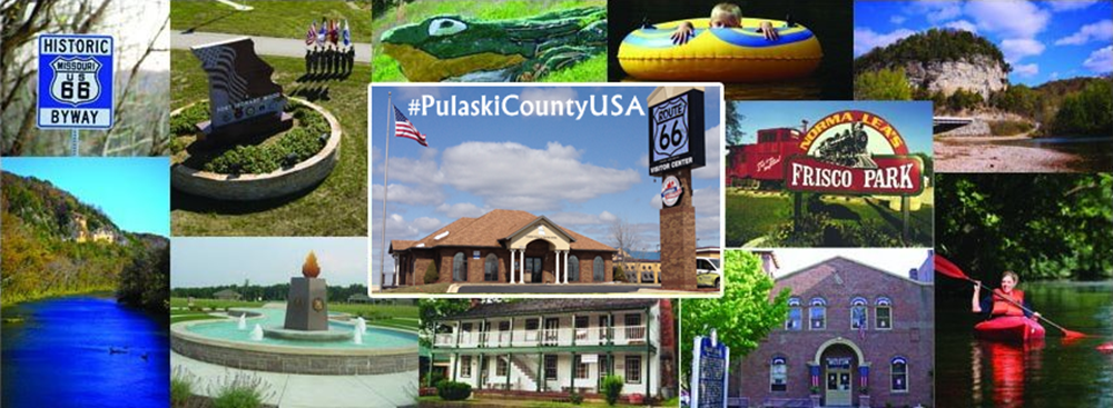


 Image by bchrismer via Panoramio.com