There are so many things to see and do in Waynesville, and Pulaski County, Missouri during the 2015 National Speleological Society Convention! The scenic beauty and fun, interesting, historic, and quirky sites does not stop at the county line so we have compiled a list of 42 choices of places to visit during your stay in the Cave State.
Missouri was named “Best Trails State” by American Trails in 2013 and we have included plenty of places for hiking. Missouri’s State Parks have been recognized as one of the top four state park systems in the nation. The Show Caves in Missouri offer everything from unsolved mysteries (did Jesse James really hide an as-yet-to-be-found fortune in Meramec Caverns, in Stanton?) to a connection with literary figures such as Tom Sawyer and Huck Finn (in five of his books, Mark Twain wrote about the cave that now bears his name). Missouri is blessed with an abundance of springs. The Ozarks comprises one of the nation’s greatest concentrations of springs and we have included some of them in this list as well. This list will lead you to Missouri’s only dinosaur, the “Little Grand Canyon”, a salvaged shipwreck, and even a cold adult beverage.

Photo by The Missouri Mom.
As you travel across Missouri, some of the things that will strike you the most also relate to Waynesville & Pulaski County. Civil War sites are scattered across the state and Waynesville’s Old Stagecoach Stop served as a Union hospital during the War Between The States. Fort Wayne was located at the top of the town hill and overlooked the Wire Road, a military trail. Route 66 closely follows that trail. Trail of Tears State Park in Southeast Missouri pays tribute to the memories of the thousands of Cherokee Indians who died during that forced march- a march that included an overnight stay in what is now Laughlin Park in Waynesville. Laughlin Park is one of only seven sites on the Trail of Tears National Historic Trail in Missouri. Laughlin Park is also home to Roubidoux Spring, one of the twenty largest springs in Missouri, and famous in the cave diving community. Downtown Waynesville is home to excellent trout fishing- just steps away from dining, entertainment, and shopping. Bloomfield celebrates America’s veterans every day in The Stars and Stripes Museum and Pulaski County is well known throughout the nation for its patriotism also. Home to Fort Leonard Wood, one of the largest training installations in the United States, missions here serve every branch of the U.S. Armed Forces. Fort Leonard Wood is the only place in the U.S. with three Army branch museums in a single location.

The Old Stagecoach Stop in Waynesville, MO.
Missouri is also known as the Show Me State and we hope that you are able to see and experience a variety of Missouri’s regions while you are here for National Speleological Society Convention in 2015!
National Speleological Society 2015 Convention logo.
1. Arcadia Valley Region-
Elephant Rocks State Park: The giant elephant-shaped boulders are the star at Elephant Rocks State Park. Hike the short distance to the Engine House Ruins, or follow the one mile Braille Trail. The first of its kind in Missouri state parks, the Braille Trail was designed especially for people with visual or physical disabilities. Bouldering, a form of rock climbing, is allowed year round at the park.
http://mostateparks.com/park/elephant-rocks-state-park
123 miles southeast from campground
Johnson’s Shut-Ins State Park: is a jewel in the Missouri State Parks system. Shoot through Mother Nature’s hydraulics in the shut-ins, hike a trail with 1.4 billion years of geologic history, splash in the beautiful Black River.
http://mostateparks.com/park/johnsons-shut-ins-state-park
115 miles southeast from campground

Johnson’s Shut-Ins State Park. Photo by Dan Feeherty.
Taum Sauk Mountain State Park: Mina Sauk Falls Trail is your route to two of Missouri’s most important geologic wonders- its highest point and its tallest waterfall. A short walk along a wheelchair-accessible trail leads to the top of Taum Sauk Mountain and the highest point in the state at 1,772 feet above sea level. Beyond this point, the trail becomes rocky and rugged and is not considered accessible to wheelchairs. The trail passes through oak-hickory woodlands that give way to rocky, open glades with expansive and impressive views of the St. Francois Mountains. The trail passes along the top of Mina Sauk Falls, the tallest waterfall in Missouri. Cascading 132 feet over a series of ledges into Taum Sauk Creek, this wet-weather waterfall flows best after a rain. A hike back up the mountain ends at the trailhead. This is a strenuous and challenging trail so be prepared for the rugged, rocky climb and carry plenty of water. Hikers may encounter water crossings in wet weather.
http://mostateparks.com/park/taum-sauk-mountain-state-park
137 miles southeast from campground
2. Round Spring Cave- Park Rangers conduct two hour lantern tours for the public of this beautiful natural cavern. These somewhat strenuous “underground hikes” are limited to the first 15 people. Tours are offered daily, at 10:00 and 2:00, during the summer months. Tickets are $5.00 for adults, $2.00 for children. Tickets go on sale 30 minutes before each tour and there are no reservations.
http://www.nps.gov/ozar/planyourvisit/round-spring-and-round-spring-cave.htm
91 miles southeast from campground
3. Fort Davidson State Historic Site- The Confederates under Gen. Sterling Price may have taken the fort, but Union efforts at Fort Davidson in the Battle of Pilot Knob were crucial to blunting the last Confederate offensive into Missouri. Fort Davidson State Historic Site preserves and interprets the running battle through the Arcadia Valley. The site’s open, grassy fields include the fort’s old earthworks, two Confederate burial trenches, and a visitor center with a narrated story of the battle and its context within the Civil War.
http://mostateparks.com/park/fort-davidson-state-historic-site
127 miles southeast from campground
4. Trail of Tears State Park- Gain a better understanding of one of the saddest chapters in American history at Trail of Tears State Park, where nine of the 13 Cherokee Indian groups being relocated to Oklahoma crossed the Mississippi River during harsh winter conditions in 1838 and 1839. The park’s visitor center tells the tale of the thousands who died on the forced march, as well as the park’s many natural features. The park also has a cheerier side: shaded picnic sites, hiking and horse trails, opportunities to fish in both the Mississippi River and Lake Boutin, and majestic views of the Mississippi River and beyond. Trail of Tears State Park is home to two outstanding trails:
http://mostateparks.com/park/trail-tears-state-park
202 miles southeast from campground
Lake Trail (2.25 miles)- The picturesque Lake Trail winds along the shoreline of Lake Boutin and then loops around the basic campground, crossing valleys and ridges. Remnants of old homesteads may be seen with evidence of clearings, old roadbeds, a man-made pond and barbed wire fencing through trees. In some places, there is evidence of rows of tulip poplars that were planted by park staff in the 1960s in an effort to reforest old farm fields. A rare plant – the pennywort — may be found on the trail early in the spring. A short section of the Lake Boutin Campground road is used for the trail loop.
Sheppard Point Trail (3 miles)- Sheppard Point Trail is located on the southeast end of the park and features sharp ridges, steep ravines and a distinctive forest type with an Appalachian flavor. Trees such as American beech, cucumber magnolia and tulip poplars envelop the hollows and valleys while oaks and hickories line the ridges. The understory has a rich growth of ferns and a rare parasitic plant called beech drops has been found. The trail ascends to the top of a ridge and heads toward the Mississippi River. Steep inclines provide impressive views from the edges of the ridge. The trail drops off the ridge and loops down to a valley and back up a steep incline to Sheppard Point. This spot is on top of an impressive bluff overlooking the Mississippi River and is a great place to view eagles. The trail has rugged terrain and is steep in places.

Trail of Tears State Park. Photo by Ben Prepelka.
5. Piney River Brewing Company- is dedicated to making distinctive craft beers that celebrate the Ozarks. Located in a 70+ year old barn near Bucyrus, MO, and named after the nearby Big Piney River, Piney River Brewing Company has earned some accolades. In April 2014 Float Trip Ale received a gold award at the World Beer Cup in the American wheat beer style. In October 2013 Old Tom Porter received a gold medal in the brown porter style at the Great American Beer Festival. If you are unable to venture to “The BARn at Brewcyrus” hop over to Hoppers in downtown Waynesville- they normally house two Piney River brews on tap.
48 miles southeast from campground
6. Rocky Falls- Few places in the Ozarks provide a glimpse of earth’s turbulent past as well as Rocky Falls. The reddish-brown rock you see here is rhyolite porphyry. It formed as molten rock deep within the earth and flowed onto the surface about 1.5 billion years ago. At the time, no living thing existed to see the awesome flow of glowing hot lava slowly advancing over the barren landscape. Normally, a stream eroding softer dolomite, a type of limestone, would make a wider valley for itself. Since the rhyolite is harder, the stream tends to stay within whatever cracks that it finds, deepening them only a little by erosion. Thus a “shut in” is formed where the harder rock has “shut in” the stream. Farther downstream, past the constricting rhyolite, the stream valley widens once again. This allows the stream to expand into a pool. Rocky Falls can be visited year round. It is located on Route NN, off of Route H east of Eminence and Winona. It has a walking trail, bathrooms, picnic tables and fire grills.
http://www.nps.gov/ozar/naturescience/rocky-falls.htm
105 miles southeast from campground

Rocky Falls by Duane K. Willis
7. Mingo Swamp National Wildlife Refuge- About 25,000 years ago, the Mississippi River ran between the Ozark Mountains and a terrace called Crowley’s Ridge. Then, around 18,000 years ago, the river shifted, slicing its way through Crowley’s Ridge to join the Ohio River further north. The abandoned riverbed developed into a rich and fertile swamp. The refuge contains the only remaining large tract of bottomland forest of 15,000 acres (61 km2) from the original 2.5 million acres (10,000 km2) native to the bootheel of Missouri. Swampwalk Nature Trail, is a handicapped accessible boardwalk that meanders 0.8 miles through the bottomland hardwood forest. Observation decks at the Monopoly Overlook, Rockhouse Marsh, and Red Mill Drive, offer outstanding views of the Mingo Basin and its wildlife. There are also three auto tour routes available: Bluff Road, Red Mill Drive, and Ozark Highlands.
http://www.fws.gov/refuge/mingo/
198 miles southeast from campground

Mingo Swamp National Wildlife Refuge. Photo by Fred Grayson.
8. Bollinger County Museum of Natural History- Home to the Missouri Dinosaur, the first and only dinosaur ever discovered in Missouri! Other exhibits included feature Lewis & Clark and steamboats.
http://www.bcmnh.org/
179 miles southeast from campground

Image by Bollinger County Museum of Natural History.
9. The Stars and Stripes Museum- Ask just about anyone who has ever served in the United States Armed Forces if they have ever read the Stars and Stripes newspaper and most of them will say yes. Especially someone who has served overseas. This worldwide and highly regarded publication traces its roots back to Bloomfield, MO during the Civil War when soldiers from Illinois regiments decided to make use of the empty Bloomfield printing office. The soldiers started printing a newspaper to report their activities and named their rag The Stars and Stripes.
When the idea of a museum of national stature was proposed to be located in Bloomfield, Missouri, many asked, “why Bloomfield?” Others suggested that such an important tribute to history should be located in our nation’s capitol, or perhaps in New York City. Certainly such an institution should not be located in a small, rural place such as Bloomfield. However, Bloomfield is the perfect place since it is the true and actual birthplace of the original military newspaper, The Stars and Stripes. The original newspaper was printed in Bloomfield, Missouri on November 9, 1861.
http://www.starsandstripesmuseumlibrary.org/
199 miles southeast from campground
10. Ste. Genevieve County- in southeast Missouri may be the state’s premier hiking destination.
Hawn State Park: home of the beuatiful Pickle Creek Trail, a short hike along a sand-bottom creek that winds between granite boulders sculpted by water, and Whispering Pines Trail, a 9.75 mile hike that highlights the park’s sandstone bluffs and stands of shortleaf pine.
http://mostateparks.com/park/hawn-state-park
138 miles east from campground
Pickle Springs Natural Area: a National Natural Landmark and home to the Trail through Time, a two mile loop trail through a pine-and-hardwood forest to outstanding rock formations, including a rare double arch. The cool, moist canyons are home to seven species of ferns and relict plants left behind by the glaciers.
http://mdc.mo.gov/discover-nature/places-go/natural-areas/pickle-springs
132 miles east from campground

The double arch at Pickle Springs Natural Area. Photo by Amateur Ramblers.
Hickory Canyons Natural Area: is a hidden gem defined by sandstone cliffs and box canyons that drip from spring through fall and freeze into ice sculptures in winter. Two short hiking trails lead to the distinctive bluffs and canyons.
http://mdc.mo.gov/discover-nature/places-go/natural-areas/hickory-canyons
135 miles east from campground
11. Missouri Mines State Historic Site- Lead has been big business in the eastern Ozarks since about 1720. Come explore its history – and see the processing plant of the former St. Joe Lead Company – in the heart of the Old Lead Belt at Missouri Mines State Historic Site. The mine’s former powerhouse has been turned into a museum that interprets the area’s lead mining history, displays actual machinery from the mines and houses one of the Midwest’s finest mineral collections.
http://mostateparks.com/park/missouri-mines-state-historic-site
119 miles east from campground
12. Grand Gulf State Park- Some people call Grand Gulf State Park the “Little Grand Canyon.” Some just call it “breathtaking.” The park is one of the natural wonders of the Ozarks, presenting the most spectacular collapsed cave system in the Ozarks. The “Grand Gulf” stretches for more than a mile between 130 foot high walls. Visitors can view the gulf from trails on top or from the floor where they can walk under the natural bridge, which spans 250 feet with a 75-foot high opening. There is no official trail leading to the bottom so visitors should use extreme caution when attempting to access the bottom.
http://mostateparks.com/park/grand-gulf-state-park
120 miles south from campground
13. Current River Cavern- One of the prettier show caves in Missouri, Current River Cavern, formerly called “Big Spring Onyx Cavern,” is exceptionally well decorated with a wide variety of natural cave formations. Current River Cavern is the first commercial cave with absolutely no wires for lighting. The cave owners use remote controlled, battery powered LED lights that give off a restricted light spectrum and minimal heat so as not to disturb the cave life or promote algae growth which can damage formations.
http://www.cavespringpark.com/cave.html
123 miles south from campground
14. Smallin Civil War Cave- Visited by explorer Henry Rowe Schoolcraft in 1818. Smallin Cave was considered to be noteworthy enough that it was cited by major publications, including the 1923 National Geographic and 1948 issue of the Ecological Society of America. The town of Ozark was a centralized location of union activity during the civil war. There is strong evidence that Smallin Cave was used for war related activities.
http://www.smallincave.com
89 miles southwest from campground

Smallin Civil War Cave. Image by Springfield Missouri Convention & Visitors Bureau.
15. Wilson Creek National Battlefield- Wilson’s Creek was the first major Civil War battle fought west of the Mississippi River, and the scene of the death of Nathaniel Lyon, the first Union general killed in combat. The bloody Southern victory on August 10, 1861, focused greater national attention on the war in Missouri. The nearly pristine landscape allows visitors to experience one of the best-preserved battlefields in the nation.
http://www.nps.gov/wicr/index.htm
93 miles southwest from campground
16. Talking Rocks Cavern- What was once considered perhaps a quick trip through an interesting cave, has evolved over the years into an experience that can easily be enjoyed for the better part of a day. Beyond the underground tour of Talking Rocks Cavern, guests can enjoy above ground fun as well. From lovely hiking trails and look-out tower to shaded picnic areas, visitors can relax, take their time and really soak in the beauty and nature of the Ozarks. Feeling like an adventurer, you can go gemstone mining and take your treasures home.
http://talkingrockscavern.com/
118 miles southwest from campground

Talking Rocks Cavern. Image by Springfield Missouri Convention & Visitors Bureau.
17. Battle of Carthage State Historic Site- The Battle of Carthage was the earliest full-scale battle of the Civil War, preceding Bull Run by 11 days. Battle of Carthage State Historic Site contains a quiet meadow and the spring that made the area an encampment for both the Union and Confederate troops during the battle. The area is little changed in its appearance since the battle was fought on July 5, 1861. A few minutes off of Interstate 44, the site interprets the battle that set the stage for a decisive showdown a month later at Wilson’s Creek.
http://mostateparks.com/park/battle-carthage-state-historic-site
135 miles southwest from campground
18. Roaring River State Park- Fight trophy trout in one of the most breathtaking settings imaginable at Roaring River State Park. The park contains one of the premier trout fisheries in the nation, stocked each night. The natural setting – towering hills above a deep blue spring — provides a scenic backdrop to adventures. Seven trails cut through the parks rugged terrain, and lodging options from campsites to cabins make Roaring River a place to experience a unique slice of Missouri. Roaring River offers several hiking options including Devil’s Kitchen Trail Devil’s Kitchen Trail’s name is derived from an odd rock outcrop that formed a roomlike enclosure. According to legend, this room, which has since collapsed, was used as a hideout by Civil War guerrillas
http://mostateparks.com/park/roaring-river-state-park
153 miles southwest from campground
19. Bluff Dwellers Cave- Bluff Dwellers Cave is a rare gem lost in the Ozark region of Missouri. The cavern has been attracting guests from across the U.S. for 85 years. Arthur Browning discovered, explored, and eventually opened Bluff Dwellers Cave to the public in 1927. The Musical Chimes formation is an icon at Bluff Dwellers. The Chimes are formed by hollow curtains of rock that are hollow within, producing a unique frequency similar to a xylophone. Another interesting geological formation is the 75′ rimstone dam located near the original discovery point of the cavern. Measuring at 75′ the dam is one of the biggest mysteries at Bluff Dwellers Cavern. The long barrier is nearly symmetrical on both sides and even makes a similar curve on both ends. The real intriguing thing about the Dam is that Geological Scientist still haven’t determined how it was formed!
http://bluffdwellerscavern.com
185 miles southwest from campground

Image by Bluff Dwellers Cave
20. Fantastic Caverns- America’s Only Ride-Through Cave – A small, family owned business, it was discovered in 1862 by an Ozarks farmer- or more precisely, by his dog, who crawled through an entrance. It wasn’t until five years later that the first exploration took place: 12 women from Springfield, answering a newspaper ad seeking explorers, ventured into the cave. Their names remain on a cave wall today.
http://www.fantasticcaverns.com/
83 miles southwest from campground

Fantastic Caverns. Photo by Craves, Caves, & Graves.
21. Marvel Cave at Silver Dollar City- Silver Dollar City theme park evolved around the entrance to one of nature’s greatest wonders, Marvel Cave. In 1894, Canadian entrepreneur William Henry Lynch and his two daughters, Miriam and Genevieve, opened the cave as an Ozarks tourist attraction. For more than 50 years, Marvel Cave operated as a tourist show cave. In 1950, Hugo Herschend, a Danish immigrant from Chicago, his wife Mary and sons Jack and Peter, leased the cave. By 1960, the Herschends introduced their 1880s Ozark Mountain Village, Silver Dollar City theme park. The theme park was literally built around the entrance to Marvel Cave, upon the foundations of a genuine 1800s mining town – Marmaros. Marvel Cave is a wet limestone cave, complete with formations that are still alive and growing! To begin, you will travel 300 feet below the surface and enter the Cathedral Room. The breathtakingly beautiful Cathedral Room is the largest cave entrance room in the United States. The visitors’ trail consists of stairs and ramps. The tour lasts approximately 60 minutes, with most of that time spent climbing nearly 600 stairs. The strenuous nature of the tour requires us to not recommend the tour for visitors with heart or lung conditions, bad backs, weak knees or ankles. A trained cave guide will host your journey and provide you with interesting and entertaining anecdotes of historical or geographical importance.
*If you wish to only visit Marvel Cave and not the rest of the theme park please visit Guest Relations to purchase your ticket.
http://www.silverdollarcity.com/theme-park/attractions/rides/Marvel-Cave.aspx
120 miles southwest from campground
22. Miller Cave- Miller Cave, located on Fort Leonard Wood, is part of a cave complex in the bluffs above the Big Piney River. This cave contains archaeological evidence that people occupied this area between 7,000 B.C. and A.D. 1400. The cave has a total of four entrances. The primary entrance is located approximately 150 feet above the river, two more openings face the river and afford a spectacular view of the Big Piney River valley.
http://www.wood.army.mil/newweb/garrison/miller_cave.html
13.2 miles to Fort Leonard Wood west gate from campground

Miller Cave overlooks the scenic Big Piney River valley. Photo by Dustin Holmes.
23. Rock Bridge Memorial State Park- One of the highlights at Rock Bridge Memorial State Park is Devil’s Icebox Trail. Devil’s Icebox Trail is primarily a boardwalk with several short spurs, viewing platforms and numerous stairs. The trail takes visitors to the most impressive geological features in the park including the 63-foot high natural tunnel known as the Rock Bridge and the double sinkhole entrance to Devil’s Icebox and Connor’s Cave. Also of interest are a limestone glade, Connor’s Spring and a valley formed by the collapse of part of the Devil’s Icebox Cave system. Displays tell visitors more about the cave system and the area’s history. The hike down the stairs to the double cave entrance is refreshingly cool in the summer months. Devil’s Icebox Cave, which is upstream (to the right) is closed to the public. Visitors are permitted to wade in the underground stream at the cave entrance and into the 150-foot long Connor’s Cave, which is downstream (to the left). Flashlights, helmets and good shoes are recommended. The trail shares a short section with Spring Brook Trail and links to Sinkhole Trail.
http://mostateparks.com/park/rock-bridge-memorial-state-park
101 miles north from campground

Rock Bridge Memorial State Park. Image by The PhotoRun.
24. Jacob’s Cave- is Lake of the Ozark’s largest and most scenic cave. Famous for its depth illusion, reflective pools, ceiling sponge-work, prehistoric bones (mastodon, bear, and peccary), and the world’s largest geode. Evidence of six ice ages and three earthquakes can be seen in the cave.
75 miles north from campground
25. Ozark Distillery- is the first legal distillery in Camden County, Missouri at the beautiful Lake of The Ozarks. Family owned they hand craft their moonshine in small batches. Other Missouri moonshine distillers include Mad Buffalo Distillery in Union and Copper Run Distillery in Walnut Shade.
http://www.ozarkdistillery.com/
52 miles northwest from campground
26. Lake of The Ozarks State Park- has nine hiking trails for you to explore. The shortest trail, Bluestem Knoll, is less than a mile long. The 12.75 mile Honey Run Trail is a favorite of endurance fans and mountain bikers. A portion (.60 mile one way) of Fawn’s Ridge Trail is wheelchair accessible. Hidden Springs Trail makes its way past a small family cemetery of yesteryear and Shady Ridge Trail offers stunning views of the lake.
http://mostateparks.com/park/lake-ozarks-state-park
33 miles northwest from campground
Ozark Caverns: also located in Lake of The Ozarks State Park is home to Angel Showers. An unusual cave phenomenon, Angel Showers is a featured part of the Ozark Caverns tour. The never-ending shower of water seems to come out of the solid ceiling of rock. This interpretive tour lasts approximately one hour and is a half-mile round trip. Topics discussed include general cave development, speleothem formation, cave life or other topics visitors wish to discuss with the guide. Appropriate for all ages.
http://mostateparks.com/page/54199/cave-tours

Angel Showers at Ozark Caverns. Photo via Flckr MoGov.
27. Ha Ha Tonka State Park- Imposing architecture and breathtaking scenery combine to make Ha Ha Tonka State Park one of Missouri’s most treasured spots. Located on the Lake of the Ozarks, the park features the stone ruins of a turn-of-the-20th-century castle built by a prominent Kansas City businessman high atop a bluff. More than 15 miles of trails traverse the park, leading visitors to sinkholes, natural bridges, caves and down to the lake.
http://mostateparks.com/park/ha-ha-tonka-state-park
43 miles northwest from campground

Vintage postcard depicting Ha Ha Tonka Castle Ruins overlooking The Lake of the Ozarks Missouri.
28. Arabia Steamboat Museum- “200 Tons of Treasure” When the mighty Steamboat Arabia sank near Kansas City on September 5, 1856, she carried 200 tons of mystery cargo. Lost for 132 years, its recovery in 1988 was like finding the King Tut’s Tomb of the Missouri River. Remarkably preserved clothes, tools, guns, dishware and more. The discovery was truly a modern day treasure-hunting story at its best. Using a metal detector and old maps to guide the search, an amateur archaeologist began the search for the lost steamer. Located a half-mile from the present river’s course, 5 men and their families would begin the adventure of a lifetime … recovering the Steamboat Arabia.
http://1856.com/
195 miles northwest from campground
29. Bagnell Dam History Museum at Willmore Lodge- The Great Osage River Project has been recognized as one of the greatest engineering and construction feats of its time. Started in 1929 and completed in 1931, Bagnell Dam is 148 tall concrete gravity dam that impounds the Osage River and created the 55,000 acre Lake of the Ozarks.
http://www.willmorelodge.com/
46 miles northwest from campground
30. Bridal Cave- Centuries ago the Osage Native American Indians discovered the pristine beauty that lies beneath Thunder Mountain. Local folklore tells of a legendary Native American Indian wedding ceremony held in the cave in the early 1800s. Today this magnificent natural wonderland is called Bridal Cave. In keeping with the tradition of the Native American legend, the Cave can be reserved for a romantic wedding chapel. Over 2,500 couples from around the world have exchanged vows in the stalactite adorned Bridal Chapel.
http://bridalcave.com/
48 miles northwest from campground
31. Jesse James Farm & Museum- Jesse James, son of a Baptist minister, was born at the family home in Kearney, Missouri, in 1847. Barely 16, he followed his older brother, Frank, into the Civil War. While Frank was a member of Quantrill’s guerillas, Jesse rode with Bloody Bill Anderson. When the war ended, Jesse returned home and joined other former Confederate guerillas in a life of outlawry. Jesse’s boldness and flamboyance as a bank and train robber, combined with sensational publicity from newspapers and dime novels, soon made his a household name. A tour through the restored home will take visitors back to where the legend began. Before walking the trail to the farmhouse, a twenty minute movie recaps the history of Frank and Jesse James and exploits of the outlaws. The museum displays the world’s largest collection of James family artifacts. Jesse’s boots and Frank’s surrender letter tend to captivate visitors. Guests then follow the paved winding trail to the farmhouse and walk along the creek where, as young boys, Frank and Jesse spent much of their time playing. In the yard of the family home is Jesse’s original burial site, the place where his mother once sold souvenir rocks from his grave for twenty five cents.
http://www.claycountymo.gov/Historic_Sites/Jesse_James_Farm
220 miles northwest of campground
32. Onondaga Cave State Park- Descend into the depths of Onondaga Cave State Park and drop into a world of wonder: towering stalagmites, dripping stalactites, and active flowstones help make the cave a National Natural Landmark and illustrate why Missouri is often called “The Cave State.” Visitors can take guided tours into the underground wonderlands of Onondaga Cave and Cathedral Cave.
http://mostateparks.com/park/onondaga-cave-state-park
70 miles northeast from campground

Onondaga Cave. Photo by Onondaga Friends Association.
33. Shaw Nature Reserve- is the “country cousin” of the Missouri Botanical Garden and has a complex of trails that take you through restored prairies, upland woods with bluff overlooks and bottomland forest filled with giant sycamores to a gravel bar perfect for lunch on the Meramec River.
http://www.missouribotanicalgarden.org/visit/family-of-attractions/shaw-nature-reserve.aspx
101 miles northeast from campground
34. Anheuser-Busch Brewery Tours- is a complimentary tour that offers visitors of all ages an in-depth look at how some of America”s favorite beers are crafted, using the finest, all-natural ingredients, by following it through the steps of the entire brewing process. Since its founding in 1852 in St. Louis, Missouri, Anheuser-Busch has been perfecting this process, taking pride in producing some of the world’s finest beers, one batch at a time. Those who are 21 and older will get a chance to sample their product in the historic Brewhouse built in 1891. Guests will also have an opportunity to taste another sample of their quality products in The Biergarten at the conclusion of the tour, where soft drinks are also available.
http://www.budweisertours.com
139 miles northeast from campground
35. Clifty Creek Natural Area- Clifty Creek was the first designated natural area in Missouri (1971). Visitors will see the geologic wonder that is the 40 feet long natural bridge over Clifty Creek and hike through a microcosm of Ozark natural communities from dry glades to lush stream bottoms. A wide variety of birds can be spotted year round.
http://mdc.mo.gov/discover-nature/places-go/natural-areas/clifty-creek
33 miles northeast from campground

Under the arch at Clifty Creek. Photo by Greg Wacker.
36. Mark Twain Cave Complex- The Mark Twain Cave Complex boasts America’s Oldest and Newest Show Caves. Mark Twain Cave is Missouri’s first Show Cave. The cave was first shown in 1886 and is a Registered National Natural Landmark. Experienced guides will escort you on the 55 minute tour of Mark Twain Cave where the walkways are level and smooth, and there are no steps. Because of the natural state of the cave it is not wheelchair accessible. Cameron Cave is a 1 hour and 20 minute tour, and several people will carry lanterns as the cave is very nearly like it was first discovered in 1925.
181 miles northeast from campground

A Cameron Cave guide demonstrates an unusual feature of the cave. Photo by Flckr MoGov.
37. Meramec State Park- is home to Fisher Cave. Fisher Cave is truly one of the park’s most spectacular natural wonders. Naturalist-led tours, offered on a seasonal basis, provide an interesting adventure for park visitors. From the low, narrow streamside passages to the huge rooms filled with calcite deposits, Fisher Cave offers one outstanding cave scene after another. Inside these rooms and passages are well-preserved bear claw marks, cave wildlife and a vast array of calcite deposits ranging from intricate hellectites to massive columns 30 feet tall.
http://mostateparks.com/park/meramec-state-park
73 miles northeast from campground
38. Rosati Winery Museum- The Rosati Winery Museum is steeped in old- time Missouri history which documents a little known American immigration story. For a unique museum experience; buy a glass or bottle of wine from the tasting room and proceed to sip and learn as you wander through the museum. Missouri has many wineries that you can taste and tour. For a full listing visit http://www.missouriwine.org.
http://rosatiwinerymuseum.com/Museum.html
50 miles northeast from campground
39. Meramec Caverns- marketed as “Missouri’s Buried Treasure”, Meramec Caverns is the largest commercial cave in the state of Missouri. Guided tours by trained rangers are conducted along well-lighted walkways. All cavern facilities are accessible to the disabled. Learn how an ancient limestone “Wine Table” and an entire 7-story mansion were built… all underground. On tour you will see both the rarest and largest cave formations in the world.
82 miles northeast from campground

Meramec Caverns still uses barns as billboards in their marketing. This barn, located on Highway 41 near Noah, Tennessee was photographed by Brent Moore.
40. Missouri Highway 36 Road Trip- “The Way of American Genius” Discover some of America’s great ideas, inventions and innovators along Missouri Highway 36. A trip across northern Missouri features iconic American stories about the Pony Express, JC Penney, General John J. “Black Jack” Pershing, Walt Disney and Mark Twain, to name just a few. To obtain a copy of the audio CD that accompanies this tour, please contact the Hannibal Convention and Vistors Bureau.

Walt Disney first came to Marceline, Missouri by train when he was five years old. When Walt returned to Marceline in 1946 the Santa Fe train depot evoked cherished memories of when he first pulled into the Marceline. As a fitting tribute, the museum that honors him is located inside the very same train depot. Photo by John & Sigrids Adventures.
41. U.S. Route 61 Road Trip- Nicknamed the “Avenue of The Saints” because it connects St. Paul, Minnesota to St. Louis, the route continues south of St. Louis to New Orleans, Louisiana. The highway generally follows the course of the Mississippi River, and is designated the Great River Road for much of its route. The highway is often called “The Blues Highway”, because of the course it takes from Minnesota, through Memphis, Tennessee and into Louisiana. The “rock ‘n roll crossroads of America”, where Route 66 meets Route 61 is in Kirkwood, Missouri.
http://www.visitmo.com/trip-ideas-in-missouri/take-a-ride-on-route-61-north.aspx
http://www.visitmo.com/trip-ideas-in-missouri/take-a-ride-on-route-61-south.aspx

A trip south on U.S. Route 61 will take you to New Madrid, Missouri and it’s beautiful riverfront park. The Mississippi is clearly the most significant physical landmark in the area of New Madrid. The river’s history is closely intertwined with that of the city. As with the original French trading post that preceded it, New Madrid was established along the river’s edge because the Mississippi was the primary artery for commerce in the 18th and early 19th centuries. In time, the original town site was eroded by recurrent floods on the river, and New Madrid was forced to adjust its location because of the vagaries of Mother Nature. For a few hours, the violent earthquakes of the early 19th century reversed the course of the mighty river. Half a century later, Union and Confederate forces turned the area into a Civil War battlefield in the fight for control of the river. Photo by Jackson Trippers.
42. U.S. Route 66 Road Trip- Sometimes a road is more than a road. The perfect road trip road can become a legend. And “The Mother Road” is the epitome of legendary roads. This great American highway is embraced worldwide by fans who seek it out more for the road itself, and its people, than the final destination. Originally connecting Chicago, Illinois to Santa Monica, California the road also travels through Missouri, Kansas, Oklahoma, Texas, New Mexico, and Arizona. In Missouri, no Route 66 trip would be complete without stops at Ted Drewes Frozen Custard, the ghost town of Arlington, world famous Elbow Inn & BBQ in Devils Elbow, Munger Moss Hotel, & Gary’s Gay Parita.
http://www.visitmo.com/trip-ideas-in-missouri/route-66-part-one.aspx
http://www.visitmo.com/trip-ideas-in-missouri/route-66-part-two.aspx

John’s Modern Cabins near the ghost town of Arlington, MO on Route 66 in Phelps County. Photo by Population 91.
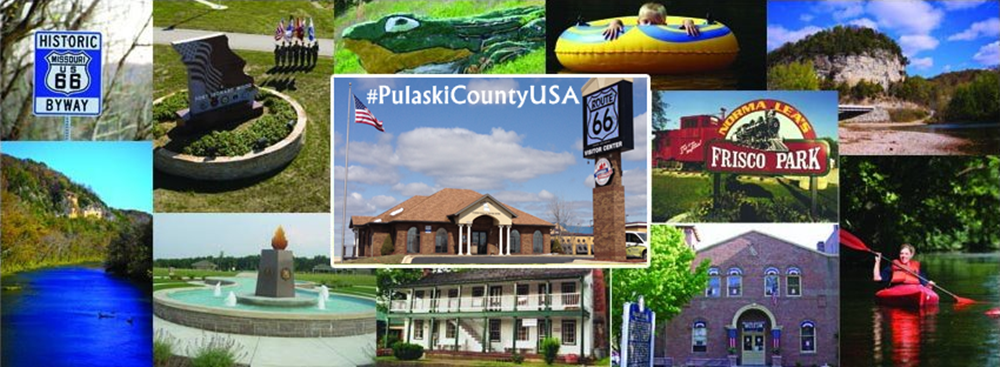
Needing more trip ideas and things to see and do while in Missouri for the 2015 NSS Convention? Don’t panic! For a complimentary Pulaski County Visitors Guide simply call 877.858.8687 or send a message to email@pulaskicountyusa.com. For a free Official Missouri Travel Guide please visit: http://www.visitmo.com/official-missouri-printed-travel-guide-order-form.aspx
Stay in the conversation! Use hashtags #NSS2015, #VisitMO, and #PulaskiCountyUSA
![]()


