Chimney Pawn & Gun Shop

Chimney Pawn & Gun Shop advertisement as published in the 1984 edition of Old Settlers Gazette.

Chimney Pawn & Gun Shop advertisement as published in the 1984 edition of Old Settlers Gazette.

Today’s #ThrowbackThursday post reaches back to 1984. This ad for Chimney Pawn & Gun Shop was printed in the Old Settlers Gazette. Chimney Pawn & Gun was located on the Fort Wood Spur (now Missouri Boulevard). Operated by the Livingston family, the shop was named for the chimney that was near the store. The old chimney was all that remained of the African American NCO Club. Sadly, Chimney Pawn & Gun has closed, and the chimney has been dismantled. However, you can see items similar to what they offered this weekend at the Kickapoo Trace Muzzleloaders Trade Fair in Saint Robert. #PulaskiCountyUSA

The Spirit of Pulaski County

Pulaski County, Missouri has a long and proud tradition of patriotism. In remarkable spirit, citizens laid their cash on the barrel head in return for Uncle Sam’s war bonds during several War Loan Drives to support the war efforts of World War II. War Loan Drives were held nationwide and Pulaski County stepped up to the plate. The third War Loan Drive was held from early September through early October in 1943 with a national goal of $15 billion and the county quota was $336,000. With Dru Pippin as the chairman from the county, Pulaski County delivered $341,787, almost $6,000 over goal. Adjusted for inflation the money raised by Pulaski County in 1943 would equal $4,604,621.64 today. $75,000 of the monies raised bought a P-51 Mustang which was named “The Spirit of Pulaski County” by local bond buyers. After purchasing a Series E War Bond the buyer was able to submit a naming suggestion.

North American P-51 Bought with the 3rd War Loan Drive. "The Spirit of Pulaski County". P-1 Mustang. Photo courtesy of Pulaski County Museum & Historical Society.

North American P-51 Bought with the 3rd War Loan Drive. “The Spirit of Pulaski County”. P-1 Mustang. Photo courtesy of Pulaski County Museum & Historical Society.

Pulaski County, always patriotic and dutiful, had seen many of her citizens march off to war, but part of the rallying cry for the War Loan Drives was the memory of Wayne Lynn “Buck” Bandy. A graduate of Waynesville High School, Buck played trumpet for Navy Band Number 22, and was one of the many sailors lost on board the U.S.S. Arizona December 7, 1941.

Dru Pippin said of the successful War Loan Drives:

“This magnificent response to put idle dollars to work for victory is our message to our fighting men wherever they might be, that Pulaski County has gone to War too.”

This Third War Loan poster featured Superman.

This Third War Loan poster featured Superman.

Many businesses were advertisement sponsors for the War Loan Drives including Long’s Drug Store Sundries, United Army Store, Rigsby Service Station, Baker Hotel, Dr. C.A. Talbot, Owl Cafe, Clark’s Cafe, Chicago Military Store, Prewett Liquor Store, Bell Hotel, Bursons Cafe, Ford Cafe, Copeland Military Store, Sinclair Service Station, Blue Line Bus Service, Tut’s Cafe, Fort Wood Hotel, Ft. Wood Military Supply, 5% Beer Parlor, Safety Service Station and Bell Garage.

Today, over 70 years later, Pulaski County still fervently supports those who put their life on the line to fight for our freedoms. Pulaski County was the first Purple Heart County in the State of Missouri, and several of our cities have received the Purple Heart City designation as well.

Special Thank You to Steven M. Beattie and Pulaski County Museum & Historical Society for their contributions and images.

To plan your trip to Pulaski County, Missouri, home of Fort Leonard Wood, visit http://www.PulaskiCountyUSA, like us on Facebook at http://www.facebook.com/PulaskiCountyUSA, or order your FREE Official Visitors Guide at email@pulaskicountyusa.com or 877-858-8687.

The Civil War in Pulaski County, Missouri- Conflict In The Midwest

The battle lines had been drawn, and Americans picked up their weapons. The Civil War was about to change the face of the nation as they knew it. Most of us are familiar with the battle that raged on the East coast, but what about the Midwest? Few realize the impact the Civil War had on both historic, and present-day Pulaski County.

While alliances were mostly clear in the East, loyalties were much hazier in Pulaski County. Missouri was Confederate territory and, indeed, Waynesville initially flew the Confederate flag. The rugged terrain and relative isolation of the Missouri frontier shielded locals from strong opinions for or against slavery, however, and secession from the Union held little immediate consequence. As debate raged in the young country, the prevalent support in Pulaski County remained with the South; the presidential election of 1860 yielded only seven votes for Abraham Lincoln to John Breckenridge’s 281. As war became imminent, however, opinions began to shift, and this trend continued throughout the war. In Pulaski County, neighbors, families and friends found themselves on opposite sides of the battlefield.

It soon became clear that the key supply road from St. Louis to Springfield would be critical to either side’s success, placing Pulaski County as a main thoroughfare. What is now Route 66 was, at the time, a path for transporting troops and supplies for each army; the Union Army eventually strung a telegraph wire along the route, resulting in its nickname of “The Wire Road”.

Fort Waynesville in Staat Missourie U.S.  Oil on canvas, painting by Franz Wilhelm Leuteritz, 1864 MHM Collections For an interactive, zoomable version of this image visit: http://www.civilwarmo.org/gallery#item/CWMO-33

Fort Waynesville in Staat Missourie U.S.
Oil on canvas, painting by Franz Wilhelm Leuteritz, 1864
MHM Collections
For an interactive, zoomable version of this image visit:
http://www.civilwarmo.org/gallery#item/CWMO-33

Many Pulaski County farmers joined either the Union Army or Confederate militias or guerrilla groups , and by 1862, Waynesville had become the center of the war in Pulaski County. While a few women remained to support local fighters, most fled with their children to safer territory. Union soldiers took over the town and erected a large fort on Fort Street, overlooking the downtown square. A marker at the site is now all that remains of the fort. The Pulaski County Courthouse was so badly damaged by rifle fire that it had to be torn down in 1870. The stagecoach stop, which still stands as The Old Stagecoach Stop museum in downtown Waynesville, was converted to a hospital for wounded soldiers.

Waynesville Fort Historical Marker erected by Pulaski County Historical Society and Museum in 1970. Photograph courtesy of Laura (Abernathy) Huffman, 2009.

Waynesville Fort Historical Marker erected by Pulaski County Historical Society and Museum in 1970. Photograph courtesy of Laura (Abernathy) Huffman, 2009.

As Union forces patrolled the streets, the wilderness was alive with Confederate militias that ambushed supply wagons. Pulaski County’s rugged terrain and numerous caves changed the face of battle from traditional fighting methods to brief clashes between armies. The area was host to bloody skirmishes and raids.

Old Stagecoach Stop, Waynesville, Missouri. Photograph courtesy of Laura (Abernathy) Huffman.

Old Stagecoach Stop, Waynesville, Missouri. Photograph courtesy of Laura (Abernathy) Huffman.

By the time Union troops left Waynesville in 1865, Pulaski County was deserted. Some estimates maintain that up to 75 percent of the population had left. Homes and farms were vacant. Buildings were looted and destroyed; livestock was gone, and farms were overgrown. Many citizens never returned; for a time the Ozark region remained dangerous territory.

Fortunately, word of land ownership opportunity traveled east. Southerners who had lost their homes in the war seized the opportunity and headed west to establish new roots. The Southern Pacific Railroad opened rail lines to Springfield, giving rise to numerous small towns along the tracks, opening new economic possibility and establishing much of modern-day Pulaski County.

Historical marker erected in front of the Old Stagecoach Stop in Waynesville, MO in 1970 by Pulaski County Historical Society and Museum. Photograph courtesy of Laura (Abernathy) Huffman, 2009.

Historical marker erected in front of the Old Stagecoach Stop in Waynesville, MO in 1970 by Pulaski County Historical Society and Museum. Photograph courtesy of Laura (Abernathy) Huffman, 2009.

History has not been forgotten. Pulaski County still holds many remnants of the Civil War, allowing glimpses into our rich past. Two markers indicate areas of interest from the battles. The Old Courthouse Museum holds many relics from county history; the Old Stagecoach Stop features a Civil War medical display as well as artifacts from local history. The original structure still stands as a testament to the ties that bind modern-day Pulaski County with memories of the past.

The text of this posting is a reprint of an article that appeared in “Visitor Guide Pulaski County Missouri” published by CommunityLink circa 2008.

Ranch Motel- Vintage Route 66

Vintage postcard featuring Ranch Motel on Highway 66 in Saint Robert, Missouri.

Vintage postcard featuring Ranch Motel on Highway 66 in Saint Robert, Missouri.

Ranch Motel has been a landmark on Route 66 in Saint Robert, Pulaski County, Missouri since the 1940’s. Although not original to it’s construction, the facility was “rocked” later on.

More than a map, our Route 66 Historic Auto Tours brochure has turn by turn directions with mileage (in the style of Jack Rittenhouse’s 1946 “A Guide Book To Highway 66”) historical photos and facts, including information about Pulaski County’s “best 1943 curbed pavement in the state” in the Grandview area. To receive your FREE brochure contact Pulaski County Tourism Bureau at 877-858-8687 or email@pulaskicountyusa.com.

Dadtown Store Long Remembered

During the days of Route 66, Central Motel & Station was located in Pulaski County, between Buckhorn and Hazelgreen. It was a popular stop for travelers who were “motoring west” on the “Main Street of America”. Before Route 66 was established, the site of Central Motel & Station was well known to locals as “Dadtown”.

Pulaski County Museum & Historical Society has kindly shared their published article about the Dadtown Store that was submitted by Kirk Pearce for inclusion in History Pulaski County Missouri Vol II in 1987:

Once upon a time in the Ozarks there was a place called “Dadtown,” which was a lively little place. It was located near Hazelgreen.

In the early 1900’s Dad and Betsy Lewis built a store building and put in a general line of groceries. Since Hazelgreen was the major trading center for that day in time, he only stocked items people used often. Folks from the Bellfonte Community would come there to do their small trading.

This little store become known as “Dadtown” in honor of Dad Lewis.

Lewis also built a small grist mill. The mill drew customers from both Pulaski and Laclede counties to have their corn ground. Ruby (King) Doty of Lebanon remembers going to have their corn ground with her parents many times. She tells about sitting up late at night shelling corn so it would be ready to take to mill the next morning. White corn was preferred by most of the natives around here.

The Dadtown store consisted of one large room with a big pot bellied stove in the middle.

Dadtown Store, 1910, predated Route 66's Central Motel & Station. Image courtesy of Pulaski County Museum & Historical Society.

Dadtown Store, 1910, predated Route 66’s Central Motel & Station. Image courtesy of Pulaski County Museum & Historical Society.

The big jars of mouthwatering candy in the store was a delight to any child who came into the store. There was licorice, peppermint, chocolate and white “candy cigars” among other candies.

There was a big coffee mill to grind coffee. Sugar was measured out in paper bags, as well as dried beans.
Besides groceries, Dad Lewis also sold bran and seeds. A peddler would also come around selling brooms quiet often.

The store was a favorite place for visiting. Dad Lewis was a type of person who enjoyed being with people. His byword was “byjacks,” and he used it a lot!

The first silent movies in that community were shown at Dadtown. Marion Lewis, son of Dad, set up a large tent and had a “Wild West” Show. Folks came from miles around. Those were the first silent movies most of these had seen. There were some who thought they were “for real” and got quite shaken up!

There was also a canning factory at Dadtown for a short time. In 1925 Jess Grisel put a canning factory on Jess Watson’s farm near a large spring of water. George Dougan built the factory, which was no more than a shed.
About 10 or 12 were employed there. Some of these were Ollie Carroll, Sis Watson, Hazel and Flo Patterson, Lee Bowling, Alvie Powers, Noble Dougan, Marion Howell, Velma McDaniel, Elsie Howell Dougan and Syble Arnold.
The tomatoes were put in wire baskets and dipped in hot water to loosen the peelings. Then in cold water and poured in a long trough. The ladies peeled and packed them into cans.

George Dougan did most of the scalding: Marion Howell cooked the tomatoes in a large vat, and Noble Dougan ran the capper machine.

Almost every farm in that community raised fields of tomatoes that year.

The cans of tomatoes were taken to Richland where they were labeled and shipped by train to wholesale houses.

Lit Patterson was the last owner of the Dadtown Store and operated the store for several years. He built up a good cream business and bought cream from farmers a long time.

Dadtown Store has been gone many years, but the impact it had on those who were raised there, and the friendship of neighbors, will never be forgotten.

Although Dadtown Store has been gone for many years, the site where it, and later Central Motel & Station, were is still sought out by Route 66 enthusiasts. For free turn by turn directions of Pulaski County, Missouri’s original Route 66 pavement, including locations such as the site of Dadtown and Central Motel & Station, contact Pulaski County Tourism Bureau at 877-858-8567 or visit us at http://www.PulaskiCountyUSA.com.

George M. Reed Roadside Park

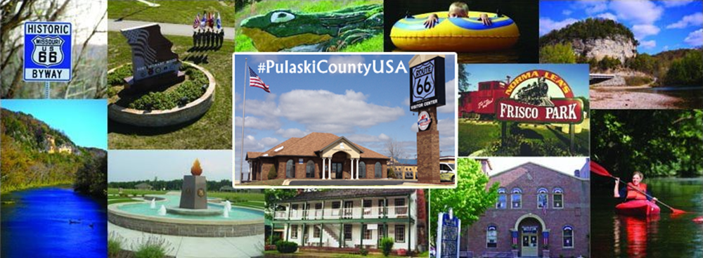
George M. Reed Roadside Park on Historic Route 66 in Saint Robert, MO is a throwback to a bygone era. Named after George M. Reed in 1952, this park is one of the last roadside parks on Route 66 in Missouri.

Today’s traveler can make their Route 66 experience authentic with a roadside picnic lunch in the park! Don’t have fixin’s for lunch with you? Many of Saint Robert’s dining establishments offer carryout. Tip- Bring a camera with you! George M. Reed Roadside Park is home to a M-60 tank from the Desert Storm era.

George M. Reed Park in Saint Robert is on of the last roadside parks on Route 66 in Missouri.

George M. Reed Park in Saint Robert is on of the last roadside parks on Route 66 in Missouri.

So…who is George M. Reed? Pulaski County Museum & Historical Society has kindly shared their published article about Mr. Reed that was submitted by Dorris Reed for inclusion in History Pulaski County Missouri Vol II in 1987:

“George Marcellus Hamilton Reed was born near Kirbeyville, Brown County, Ohio on November 24, 1855, and died November 23, 1938 in Waynesville, Mo. He was the son of John K. Reed and Sarah Burdsall Reed. His mother died in infancy and he was reared by his paternal grandparents. He had one sister of full blood, Mrs. Ella Waite, two years his senior, who died July 21, 1934 near Iberia, Mo. At the age of eleven years he joined his father First Lt. John K. Reed and sister who had settled in Missouri after the Civil War. He was carefully schooled to young manhood when he returned to his grandparents in Ohio to study teachers training. At the age of twenty-one, he returned to Missouri. He taught school his first year at Hancock. Other school services were at Dixon and later Waynesville. During all of his teaching years he privately tutored students in violin.

In 1882 he was associated with the late W.H. Murphy in the publication of the “Dixon News”. This newspaper was moved to Waynesville in 1885, and became the “Pulaski County News”. He remained with this paper six more years.

In 1892 he was admitted to the bar under Judge C.C. Bland. He had begun studying law under his father, John K. Reed of Miller Co. When his father moved to Ava, Missouri, Mr. Reed finished reading law under J.L. Johnson. At the time of his death he was the oldest practicing attorney in this judicial court, both in age and in years of practice.

Before taking the bar exam, Mr. Reed had become well known as a surveyor. In 1891 he was appointed County Surveyor and held this appointment until 1896. Since that time he has been held in the light of an expert due to his known mastery of mathematics.

It was under the Presidential administration of Theodore Roosevelt and William Howard Taft, Mr. Reed was rewarded for being an active Republican. In 1904 he was appointed Postmaster of Waynesville and held the position for ten years. In 1919 he took charge of the highways in Pulaski County under the direction of the County Court. In 1921 he became Project Engineer, by appointment, for the State Highway Department.

George Marcellus Hamilton Reed 1855-1938. Photo courtesy of Pulaski County Museum & Historical Society.

George Marcellus Hamilton Reed 1855-1938. Photo courtesy of Pulaski County Museum & Historical Society.

It was due to his many years of service in the capacity of Project Engineer that, in 1952, a roadside park on old Highway 66 in St. Roberts [sic], Missouri was named the “George M. Reed Park.”

On December 31, 1882 Miss Sarah Louella Hudson and George Marcellus Reed were married at Lebanon, Missouri. She was the step-daughter of the late attorney George W. Bradfield of Lebanon. To this union ten children were born, five, (including twins), dying in infancy and five living to maturity. Sarah Louella Reed died August 31, 1923. On March 13, 1925, he married Mrs. Sarah Farquer of Ohio, with whom he had attended school in his youth.

Mr. Reed had been a Master Mason, and was a charter member and first Master of the Waynesville Lodge, organized 50 years before. His long Masonic service was duly honored on October 11, 1938 by the presentation of the fifty year Masonic Service emblem.

He was from a long line of lawyers and Methodist ministers. He helped erect the Methodist Episcopal Church in Waynesville. He and his wife were charter members, and faithful in servitude.

Three generations of lawyers practiced in this area, John K. Reed, Iberia, George M. Reed, Waynesville, and Roy W. Reed, Crocker. Miss Ruby Reed wrote of her father in later years: “Papa was very energetic, most of the time he followed two professions or vocations at a time. He taught school over a period of thirty years, while teaching school, surveying, or practicing law at the same time. Of course this was at a time when a school term could be from ten weeks to six months. Papa also had a great thirst for knowledge. Once he was interested in a subject or activity, he wasn’t satisfied until he had mastered it.”

The old home at the corner of Lynn and Highway 66 on the square was a center for the young. They gathered to sing, accompanied by the organ and at least two violins, sometimes a trumpet.

The children of George M. Reed and Sarah Louella Reed were: Guy E.M. Reed b. 26 Oct. 1883 d. 27 June 1926 married Margot Frances Harrison b. 3 June 1893 d. 18 August 1961, Roy Wentworth Reed Sr. b. 4 May 1885 d. September 1944 married Mary Grace Neal b. 2 November 1891 d. 2 Feb 1971, Loto Marcella Reed b. 5 May 1887 d. 1943 married Harry Haney b. 12 November 1883 d. 18 February 1962, Ruby Louella Reed b. 6 May 1887 d. 3 June 1975, George Hudson Reed b. 25 April 1893 d. 14 March 1938 married M. Hazel Carmack b. September 1897 d. 22 July 1984.”

George M. Reed was laid to rest at Crocker Memorial Cemetery 25 November, 1938. Photo by www.findagrave.com.

George M. Reed was laid to rest at Crocker Memorial Cemetery 25 November, 1938. Photo by http://www.findagrave.com.

To purchase History Pulaski County Missouri, Vol II, or other books about Pulaski County Missouri please visit http://www.PulaskiCountyUSA.com/web/store.htm

For your complimentary turn by turn directions of Route 66 in Pulaski County please call 877-858-8687 or visit http://www.PulaskiCountyUSA.com

Throwback Thursday- Fort Leonard Wood Barracks

This week’s #ThrowbackThursday post is a salute to #FortLeonardWood and to United States Veterans everywhere! Help #PatrioticPulaski honor the defenders of our freedom with our #VeteranThanks project. Details can be found at goo.gl/0XpNXJ.

Millions of United States Army careers have began at Fort Leonard Wood, Missouri, many of them in barracks like those pictured on this vintage historical postcard. Fort Leonard Wood, in #PulaskiCountyUSA, was created December 1940, and except for a brief time before the Korean War has been training soldiers ever since. Today, Fort Leonard Wood trains service members from all branches of service- Army, Marine Corp, Navy, Air Force and even Coast Guard.

A squad room at Fort Leonard Wood, Missouri is the subject of this vintage postcard.

A squad room at Fort Leonard Wood, Missouri is the subject of this vintage postcard.

Brewer & Shipley: Welcome To Riddle Bridge

Brewer & Shipley: Welcome To Riddle Bridge

Brewer & Shipley, consisting of Mike Brewer and Tom Shipley, was a very popular folk music duo during the late 1960’s and early 1970’s. They are most remembered for the single “One Toke Over The Line” which was released in 1970 on their third album, “Tarkio”. Six years later, in 1976, the pair released their seventh album, titled “Welcome To Riddle Bridge” under the Capitol Records label.

The album title pays homage to Riddle Bridge in Pulaski County USA and the cover art shows Brewer & Shipley standing on the 12 panel Pennsylvania through truss bridge that was built in 1911 by Canton Bridge Company. The bridge featured on that cover was replaced circa 1987.

welcome to riddle bridge 2

Today, Mike Brewer resides outside of Branson, Missouri and Tom Shipley lives and teaches in Rolla, Missouri in Phelps County, which neighbors Pulaski County.

Locals, visitors, and tourists still gather at the Riddle Bridge site (located at the end of Y Highway) to enjoy the scenic and dramatic bluffs and the natural beauty of the Gasconade River.

To learn more about Riddle Bridge in Pulaski County USA, please visit the following links:

1985 article in the Old Settlers Gazette:
http://www.oldstagecoachstop.org/webgeezer/Gazette85/riddlebridge.pdf

1987 article in the Old Settlers Gazette:
http://www.oldstagecoachstop.org/webgeezer/Gazette87/riddlebridge.pdf

Bridgehunter.com:
http://bridgehunter.com/mo/pulaski/riddle/

To learn more about Brewer & Shipley please visit:
http://www.brewerandshipley.com/

To learn more about Pulaski County, Missouri, home of Fort Leonard Wood, please visit:
http://www.pulaskicountyusa.com

UPDATED 18 September 2019

The Normandy: Historic Route 66

Image

The Normandy: Historic Route 66

The Normandy, near Buckhorn, was a favorite eating place for locals, as well as Route 66 travelers. The restaurant, hotel, and gas station complex was razed circa 1978. A quarry is on the site now. The pillars that marked the entrance to The Normandy are still visible on the south side of the road close to the turnoff for the Pulaski County – Fort Leonard Wood Shrine Club.

Photo and background information courtesy of Terry & Jan Primas of Old Stagecoach Stop Foundation.

To obtain turn by turn directions of historic Route 66 visit: http://www.PulaskiCountyUSA.com/pdf/pulaskidrivingtours.pdf


Sterling’s Hillbilly Store: Historic Route 66

Image

Sterling's Hillbilly Store: Historic Route 66

Sterling’s Hillbilly Store was a landmark for generations of families and travelers on The Mother Road near Hooker, Missouri in Pulaski County USA. The business adapted to the changes of Route 66 and was located in four different venues throughout the years. Today, the famous “Hillbilly” sign still greets drivers as they travel the Main Street of America at the Mule Trading Post in Phelps County. Members of the Wells family continue the family tradition of basket weaving and one of their baskets can be seen on display in an exhibit at the John B. Mahaffey Museum on Fort Leonard Wood.

To learn more about Hooker, Missouri on Route 66 in Pulaski County please view the Old Settlers Gazette 2011 edition which can be found here: http://www.oldstagecoachstop.org/webgeezer/Gazette11/Hooker%20Memories.pdf

To learn more about the life of entrepreneur Sterling Wells please read the Old Settlers Gazette 2008 article which can be found here: http://oldstagecoachstop.org/webgeezer/Gazette08/Sterlingwells.pdf

To obtain turn by turn directions of historic Route 66 visit: http://www.PulaskiCountyUSA.com/pdf/pulaskidrivingtours.pdf

To learn more about the John B. Mahaffey Museum Complex on Fort Leonard Wood please visit: http://www.PulaskiCountyUSA.com/Brochures/flwmuseum.pdf